
The ‘hills’ to the east, above the two lakes, separate this area from the huge Lac du Bourget, with Aix-les-Bains on the east side and Chambery to the south. The names seem all to be associated with cats and we ascended Col du Chat, rather than use the Tunnel du Chat and then down to the lake and to a supermarket. Today is Ascension day and the people of the area are either riding bikes, sitting in cars not moving very quickly or at the Intermarché. They are here, as are we, because it’s the only place open! We need to stock up and so we fill the trolley and stand in the queue. Most of the checkout personnel must also be ‘pont-ing’ to le weekend as there are few are here.
We then retrace our steps and again drive up Chatland and this time up the D42 to Mont du Chat. The road is a cycling magnet, as it forms long switchbacks between hairpins and we ascend to 1,496m and then beautifully, we arrive at a parking spot just as it’s being vacated and slide in. There are a lot of cars and bicycles and it’s quite a spot. The restaurant has laid tables with cloths and they are doing what we simply cannot do in England and serve proper food from plates at a roadside ‘cafe’.

The best bit is the view; it’s a beautiful day and the high peaks in the distance are white. Standing high above the ones near it is Mont Blanc - it sort of takes your breath away because it is so big.

We stand and look and gaze and say “hi” to some people there who were at the campsite. What’s the chances of that?! Then we head south to the Chartreuse area and enjoy the scenery which is pastoral with big craggy outcrops. Spring growth is in full force and everything is bursting in the sun and heat.
We have a picnic by a lake, along with a lot of locals and no doubt plenty from Grenoble / Chambery. As is common in France they are mostly in family groups, often there’s three generations together.
There’s a book-bank; these seem to be very popular and come in all sizes. This is a bigger example.


The campsite here is a little quirky. Camping del Ourson. It caters for small camper vans, has a few lodges and welcomes hike-campers with a pitch for 3/4 tents. Inside the building it’s rather like an old youth hostel, with a room for cooking, eating and planning the next day. There’s a rule to remove shoes at the communal bathroom entrance but the result seems to be that many pairs are discarded, never to be worn again. In fact there’s a shelf with kids shoes on and I’m sure none of those moved the three days we were there.
The village is tiny and borders a rushing river with close-cut grass on either side, making a small park. In the heat it was a nice place to be. The loud clangs of cowbells were ever present, though and for some reason these stopped during the night for just a very few hours. They started again at 6am but I honestly don’t know why they were fitted to the poor animals, as they were kept in a field next to the farm (more like a hobby) and were not used as intended to locate the animals as they wander up and around the crags.
So morning sleep was a challenge and if the cows weren’t enough, at 7am the church bell struck the hour. At 7:05 it chimed the hour again and then there was a single bell tolling in three groups of three. Maybe there’s some Catholic Church significance to this but I don’t know what that might be.
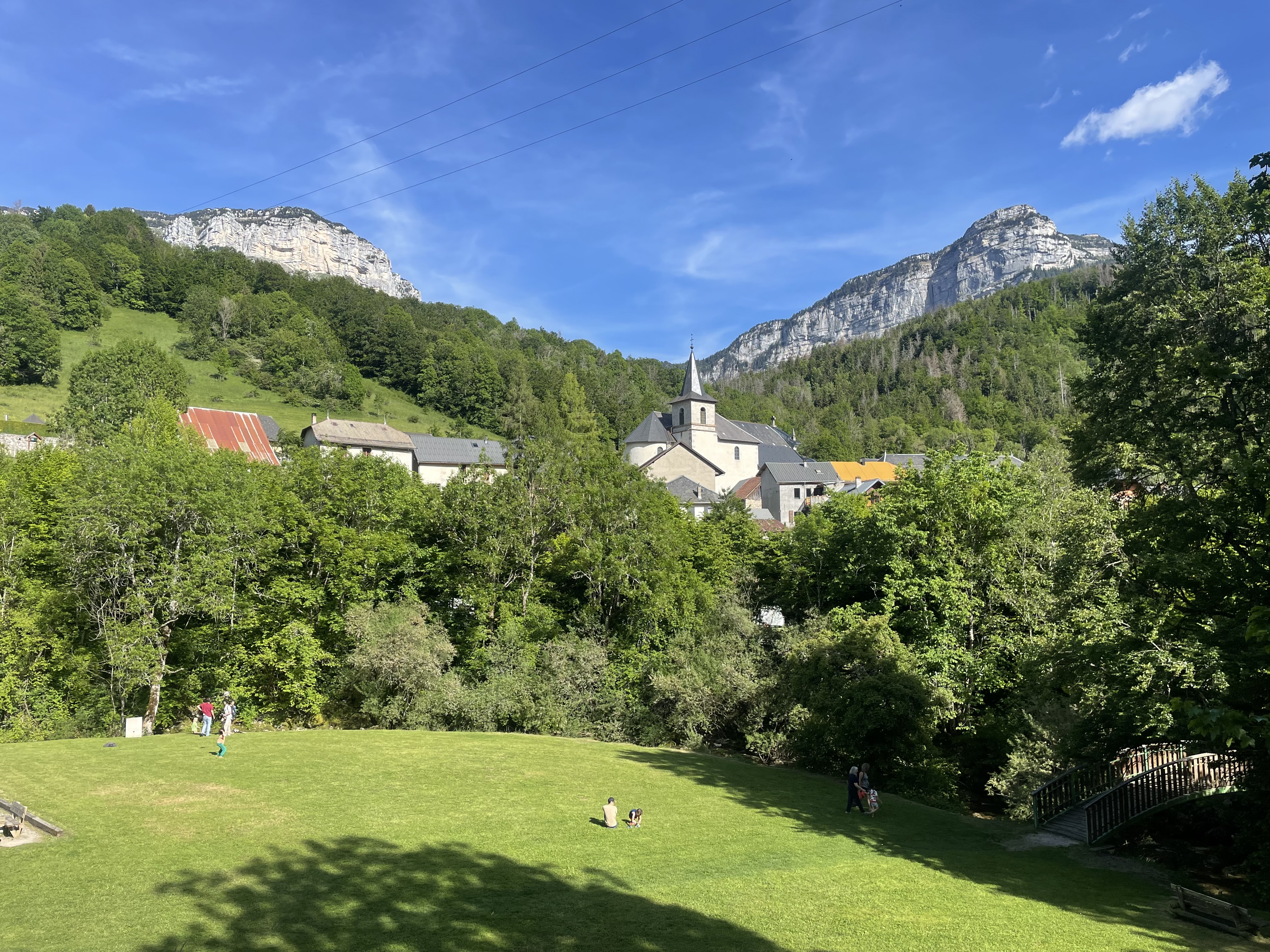


The area is beautiful and we had a great walk that was full of surprises as we followed the river downstream into what became a gorge, with the river carving through a deep canyon. It’s a small river and the canyon narrow but even so, the depth of the rocky sides and some of the pools was very surprising. It’s a long way down and there’s no getting out!
I haven’t mentioned that on morning #1, just after the 7am bells, a sole market trader came to the village car park and set up a stall just through the hedge from our pitch. It’s just as well that his Cerises tasted great, as it was another slightly early wake-up!


I’m mentioning too many negatives. Chartreuse and this village are beautiful and I haven’t seen such an idyllic alpine pasture area before, without going into the high mountains. This area is in many ways, more accessible and less daunting.
Comments