Saturday, 4 June 2022

Cañon de Añisclo


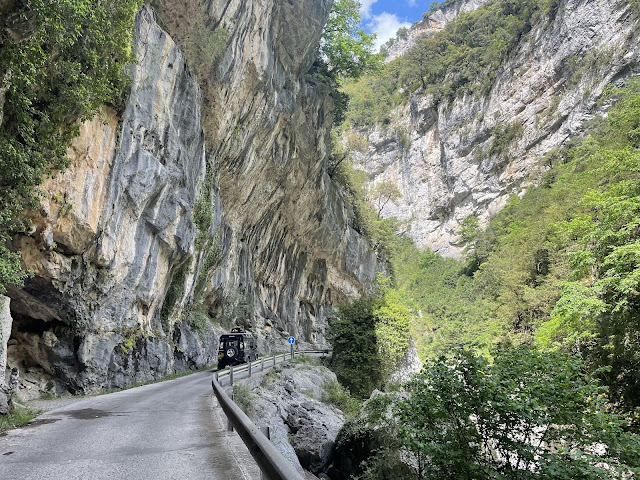
To get to one of the best situated alpine campsites in the world at Bujaruelo, we needed to get west into the next valley. We have driven to this campsite before but not on this road, through the Cañon de Añsiclo.

This aerial photo of the ravine is taken from an information board.


It starts near the village of Escalona and follows the Río Bellos roughly north west, for about 12 Km. It is very dramatic. The reason was that it passes through a ravine so narrow and so deep, that we could hardly see the top and some of the time, the bottom. When we could do so, we stopped to admire the surroundings. It is so narrow, so deep and so long, that it is a one-way drive. 


At one point we realised that we must be close to the walk of the previous day and tried to identify the crags opposite. It wasn’t possible of course but a map check suggested we weren’t far away.

I have been trying to think what makes the Pyrenees stand out, as they feel so much different than anywhere I’ve been in the Alps.

The answer I think, is that the peaks are squashed together so that there are fewer open valley floors, the sides are steeper and not cultivated, the rivers and streams run through deep, inaccessible courses and it all feels so young, in a geological sense.

I think I have read somewhere that the Iberian peninsula was a separate landmass, pushing against the European plate, with the Pyrenees the result. Maybe they are still rising and the gaps reducing and the slopes getting steeper? Time will tell.


Here’s a couple of videos that might help the story…


Link to second video here 

1 comment:

Mark M. said...

That is a unique drive. Can you imagine building that road?? Why is it there, were there mine workings or similar? Good that tou took the Landy for that road and not the Golf! It might have been a bit small.