Driving down from Formigal we were again delayed by animals on the road. This time it was a flock of sheep being driven towards us. They move quicker than cows and anyway we were at least heading into them and not with them.

There were two amusing aspects to this. Firstly, all the traffic held up behind them, would be stopped at a police checkpoint which we had seen further up the valley.
Secondly my faded eBay-sourced UK sticker for the registration plates proved to be confusing for the guys moving the sheep. They stopped to look at it and then spoke through the window.
“Ukrainii?” they asked, “No, Ingleesh” we said and laughed at how daft it seems that we have moved from the usually well recognised GB to UK, for the sake of some Northern Irish inclusivity. Perhaps it’s appreciated there, more than it is by me.

The next day we again went for a ‘walk’ and again it was in ‘the book’. This one promised sightings of the Lammergeier bearded vulture and so we embarked on what the book called, “an almost forgotten walk in the Pyrenees”.
The book was correct, as we saw the huge birds but didn’t see a soul for the whole day, once we had left the Landy. To get to the start point, at a place called Revilla, we drove 25 minutes up one of the narrowest, bumpiest, ‘tarmaced’ mountain roads that I have ever been on.
Here at 1,200m you are literally miles from anything and it feels very remote. There’s three or four houses but they are shut up. A few cars were parked as we started the walk but no one walked our way. Instead they were doing a little 1.5 hour loop to get to a mirador which we would see at the end of the day.
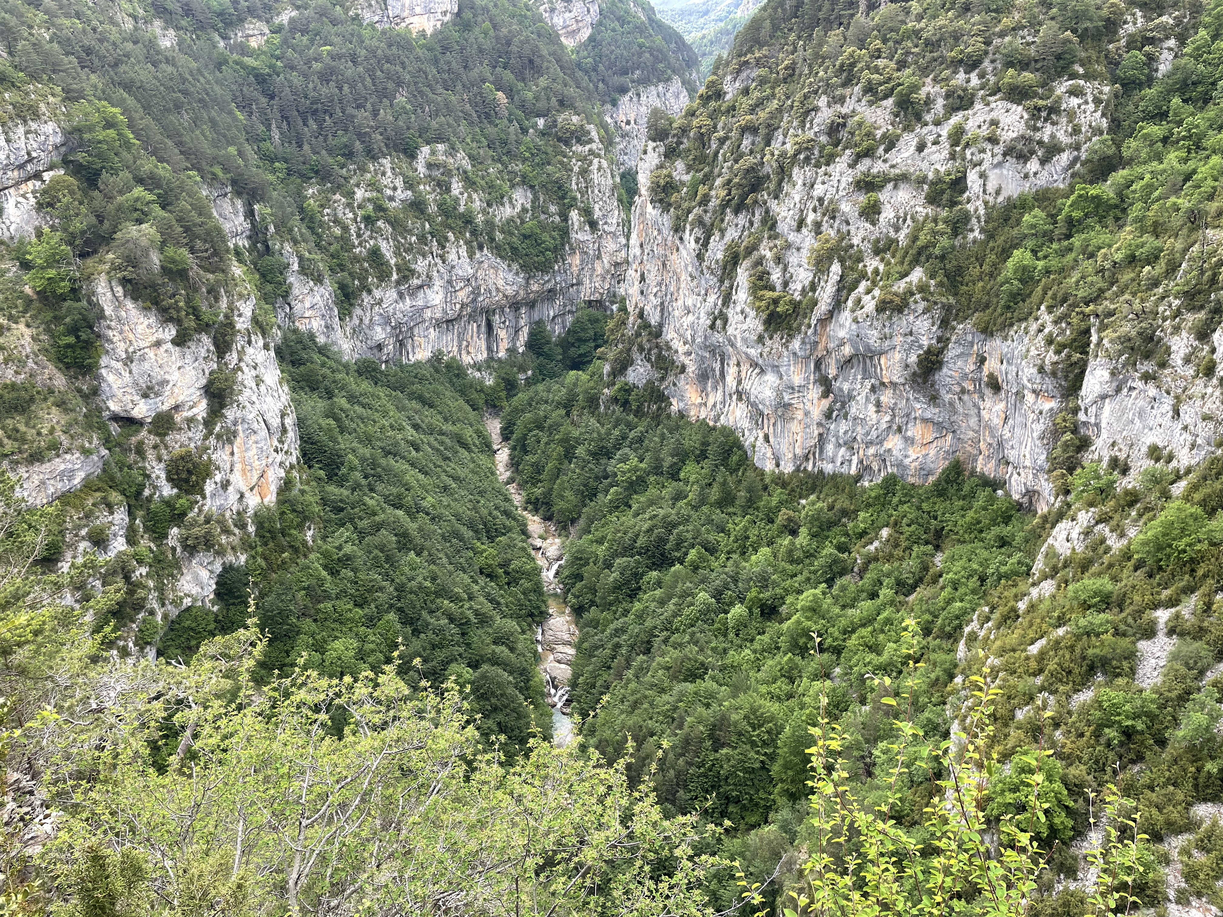
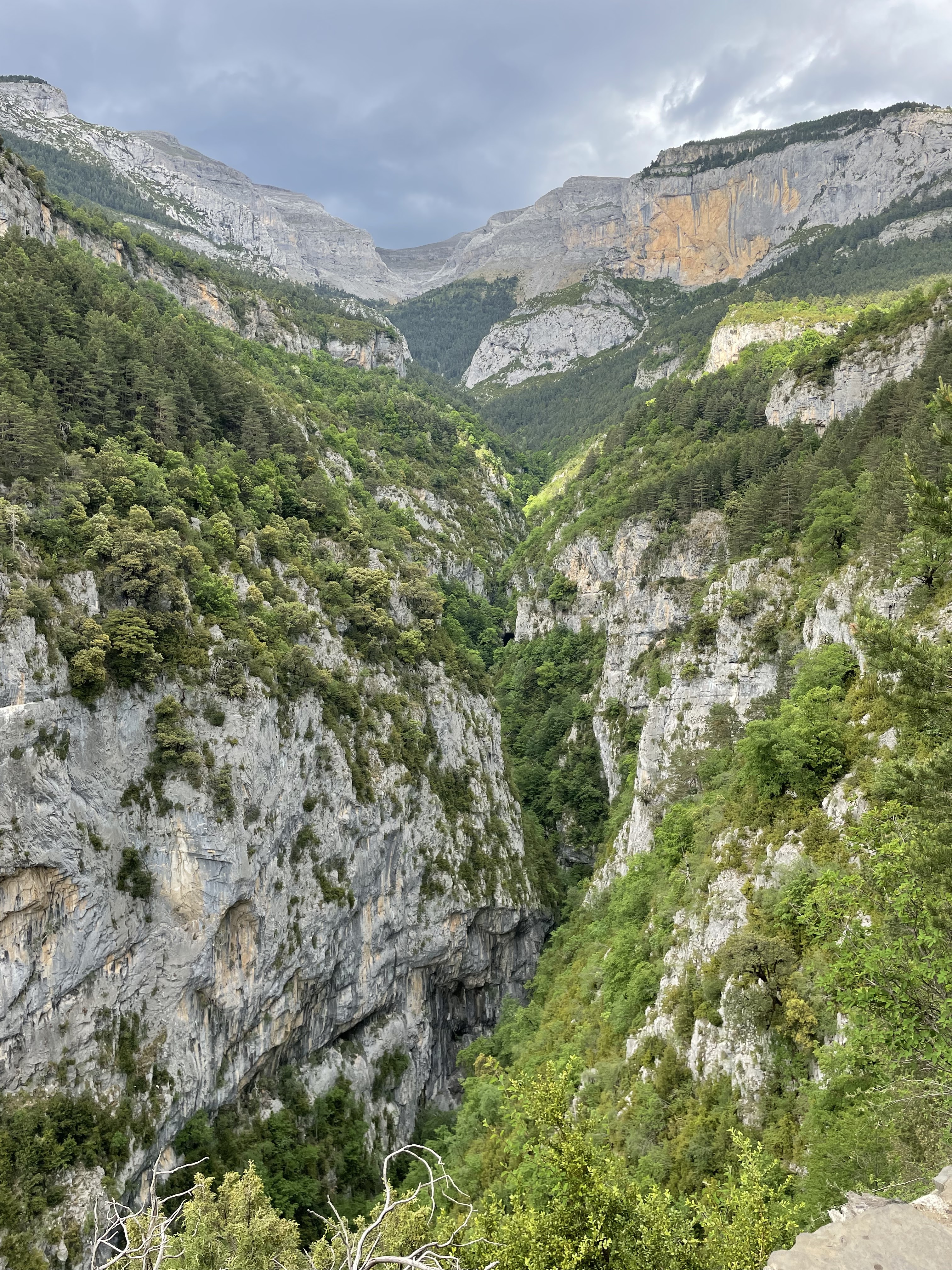
Off we went, although the first few steps were confusing and this is serious stuff. The bush is thick and there are numerous crags with big drop-offs. We had to be sure we were on the right path. The scenery is jaw-dropping and honestly we’ve never been on quite such a mountainside.
It was a steady walk through the woodland following a very narrow path that somehow lifted us up, as we walked around the crags. We again followed a Wikiloc route and this app pings you when you near a waypoint or stray off the trail.
At one major waterfall the heat was washed away


Slowly we made our way to the Refuge at just under 2,000m which we reached in about 3 hours. We really only emerged from the woods in the last 30 minutes.


When we got to the top of our walk, the sun conveniently disappeared and it was cold. We ate lunch and watched the birds.The bird photo is useless really as the birds are dwarfed by the scale of the terrain..

On the return we walked to the mirador which gave a better idea of the crazy landscape in this knife slash ravine with 2,500m heights all around.
I think we were 500m directly above the river.


You will just have to believe me about the landscape. These mountains seem to be so much more ‘enveloping’ than others. The angles are crazy, the slopes are inaccessible, the gaps are narrower and they are covered in woodland which is impossible to walk through, unless on a path.
The walk was 16 Km /10 miles)and 945m / 3,100 feet of elevation gain.
Back at the Landy we made a brew and a car arrived. A Spanish couple from Madrid had come for a walk to the viewpoint but a thunderstorm moved in just as they were establishing that as we don’t live near Liverpool we wouldn’t care that they had recently lost to Real Madrid in the Champions League final.
It poured down and these storms in mountains can be scary affairs as rocks and debris start to drop onto the road. This didn’t last long and we began the drive down. It was 14C as we left and at the campsite 35mins later it was 29C
It was quite a coincidence to go back to the campsite used the previous evening and find a Protrax group camping who were on a Pyrenees 4x4 tour. Protrax Adventures The leaders were Charles and Yvonne Morgan and we last met them on the final night of our previous trip to Spain in 2018, when we were behind them in the overnight queue for the Bilbao ferry.
Comments