
Around Flamborough Head

Moving along the coast towards Bridlington, we found a tiny CL near Bempton. It wasn’t the first choice but it might as well have been. It is next to the railway station and is a 1.5 mile walk by road to the RSPB place at Bempton cliffs, so it is a very good base.

Here they say the Puffins are arriving from west Africa but all we could see were Kittiwakes and Gannets, already establishing their nests on cliff perches.

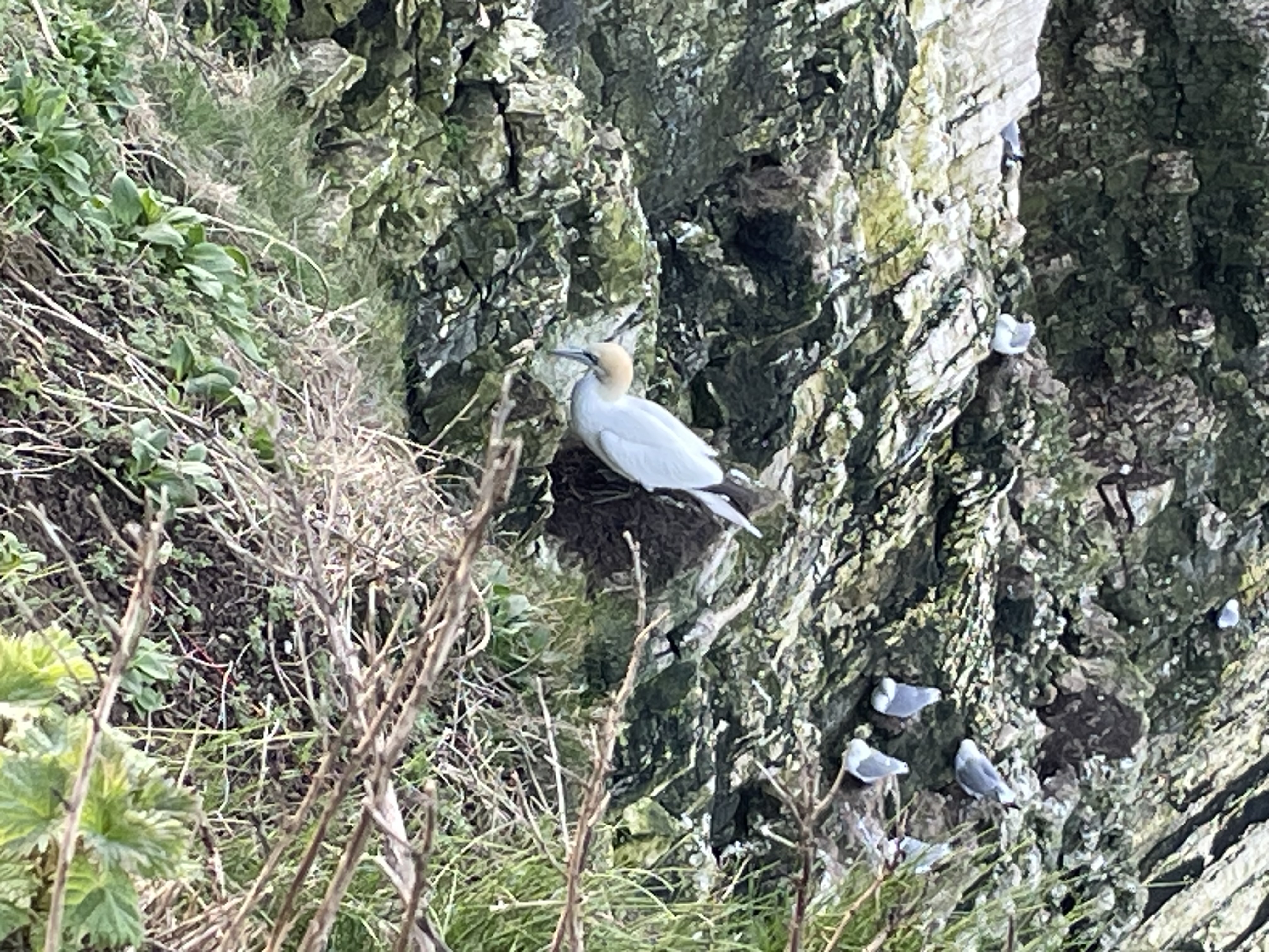


Gannets are the seabirds that are normally only seen at a distance, well out to sea and usually diving into the water from a good height and apparently at speeds up to 60mph.

Now they are circling in front of the cliff faces and occasionally dropping onto their spot. Hundreds of them, nicely avoiding the greater quantity of Kittiwakes. They are a beautiful bird, effortlessly soaring with their large wingspan.


I’m afraid that my iPhone camera is no match for the long lenses on show at the RSPB lookouts.

It was an almost freezing night but thankfully dry at last. The D2 heater was on all evening and the bright sky and cold woke us at 6:30 and we were on plan for an early start and a long walk to Bridlington.

In a stiff breeze from somewhere near Iceland we walked back to the coast path and turned east towards Flamborough Head. It’s quite a trek but at least the wind was almost behind us.

These cliffs are spectacular.


Turning towards Bridlington, we headed into the wind but instead of dropping as we expected, it got stronger and the next few miles were head down and push on.

Bridlington was a little busy but there was no queue at the favourite chip shop and we had a very late lunch.


Then onwards to the station for a 9 minute ride back on the 16:04 to Bempton. 

Comments

Popular posts from this blog

The empty map of Macedonia and into Greece

Continuing south towards the Serbia / Macedonia border, the satnav warned of a lack of detail, "do you wish to continue with this route?" However we are not intrepid explorers and Macedonia comes with a few " be careful" warnings, so we decided to stay on the motorway :-) We didn't explore Serbia; it will wait for another trip. So it was on to the border. Here, passport and V5 were required again and also proof of insurance. We didn't have any of course. When we rang the UK insurance company call centres prior to the trip, most had no idea where these countries are. They don't understand non-EU. "Macedonia - can you spell that"? The nice man at the passport office was already expecting me to say that I would buy my insurance at the "Green card office" and he handed back one passport and the V5 and put mine in his pocket until I had the necessary paper for the Landy. Unfortunately in spite of the Land Rover being classed as PL...

Remote mountains and how not to behave in them

Prior to the trip I had read somewhere that there aren’t any mountains in Portugal - at least I thought I read it. My preparations had, as usual, been focused almost totally on getting the Landy ready and Dawn, who had been doing all the other jobs was much better informed. “What? You are kidding aren’t you? Have you even looked at a map?” were some of the words she used when I told her this vital piece of information. As it became clear, there are mountains in Portugal - not massive peaks but high elevations are common and the extent of the ranges is quite large. The most remote and wild are the Serra da Peneda Gerês which rise to 1,440m but there are three others “Seras” in the Parque National da Peneda - Gerês, in which wolves roam free. First stop on they way there was the town of Guimarães, the day after “Portugal Day” and the castle and buildings were in tip-top condition. A Polish guy from Katowice who’s lived here for twenty years was selling bilberry jam in these c...

"I'm the dog"

El Berro and  Camping Sierra Espuña  are nicely positioned for walking in these 'low' Sierras and of course the obligatory GR XYZ  long distance path crosses the village. The campsite people gave us a couple of short walk suggestions, written on A4 and translated by some English guy, Michael Ball. We waited until the end of the afternoon, so that the temperature was somewhat manageable and then picked one of the ~1 hour walks that start at the campsite. The walk is so simple that there's no description, just a small diagram that's well annotated with the type of path (wide main track / footpath), other markers (gate, incorrect route, fence). You can't go wrong, can you? Well the first part was easy. Follow the path out of the village, up a valley, through woodland, up and up. Then reach the ridge and the marked ring of stones. Don't turn right, carry on straight across. Then wander through a few trees and down to a dry riverbed, at which point you walk the (ve...